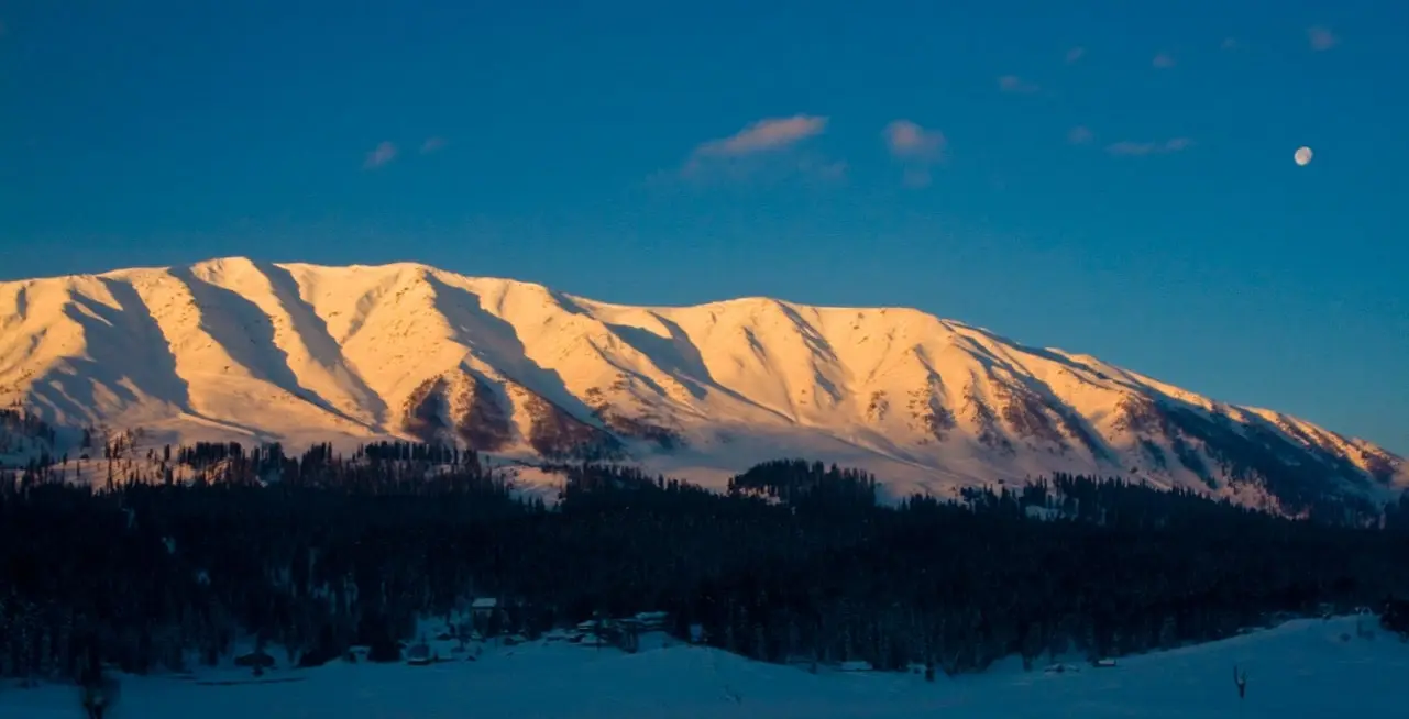
The most complete website about Gulmarg Ski Resort
Gulmarg Trail Maps
View the Gulmarg Ski Maps below to get a better understanding of Gulmarg Ski Resort.
Hover over the Gulmarg Resort Images and Maps to zoom.
It’s quite different from the modern, westernized resorts you may be accustomed to skiing. When you Ski Gulmarg, expect a larger percentage of backcountry areas that are not controlled where you ski and snowboard at your own risk – and the opportunity for more adventure and endless lines of untracked powder!
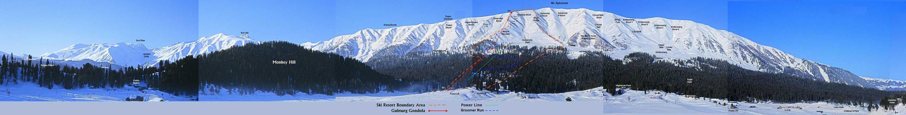
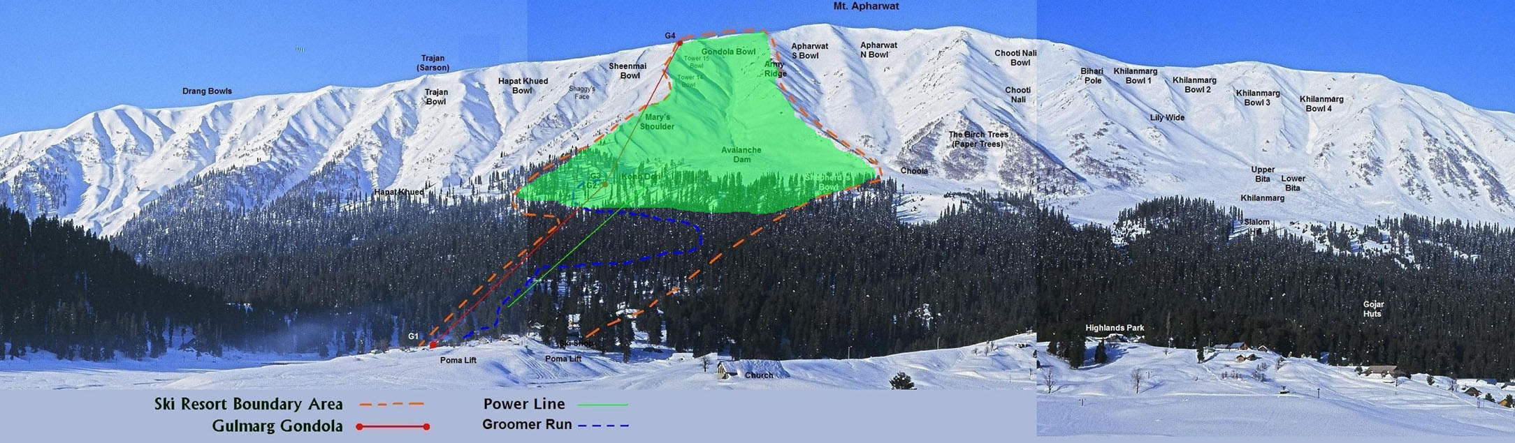
Gulmarg - The controlled ski area trail map
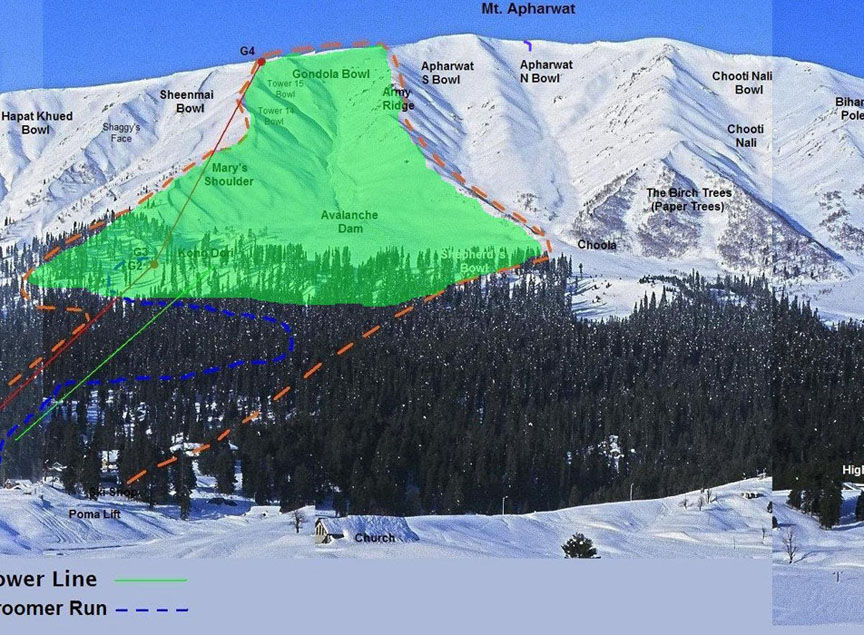
Trail Map of Gulmarg Ski Resort highlights all of the in-bound skiing options within the controlled ski area. The yellow dotted line indicates the controlled in-bound ski area boundary. In-bound ski options include some groomed runs (not groomed on a regular basis), tree skiing, and one bowl - Gondola Bowl (Mary’s Shoulder).
Gulmarg – Ski Freeride Trail Map
Freeride Trail Map of Gulmarg Ski Resort highlights all off-piste (out of bounds) skiing options. Please note that this area is not controlled by ski patrol – you are skiing at your own risk. Terrain includes endless powder fields (17 bowls) and gladed terrain.
Gulmarg – Satellite Images (Ski Trail Map)
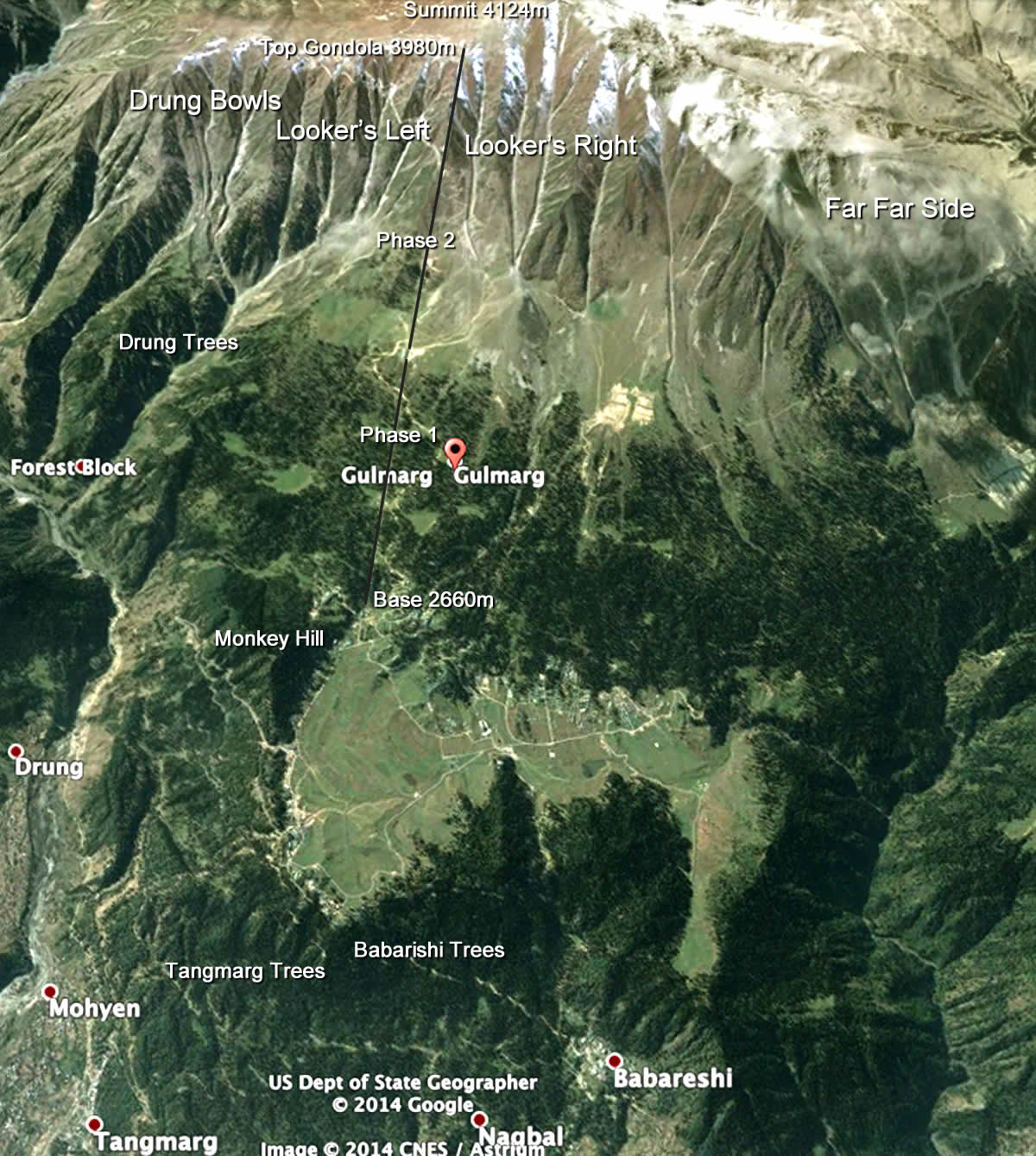
Satellite Map showing an aerial view of Gulmarg Ski Resort, Gulmarg Village, Mt. Apharwat Summit, and surrounding areas.
Gulmarg – Topographic Map (Ski Trail Map)
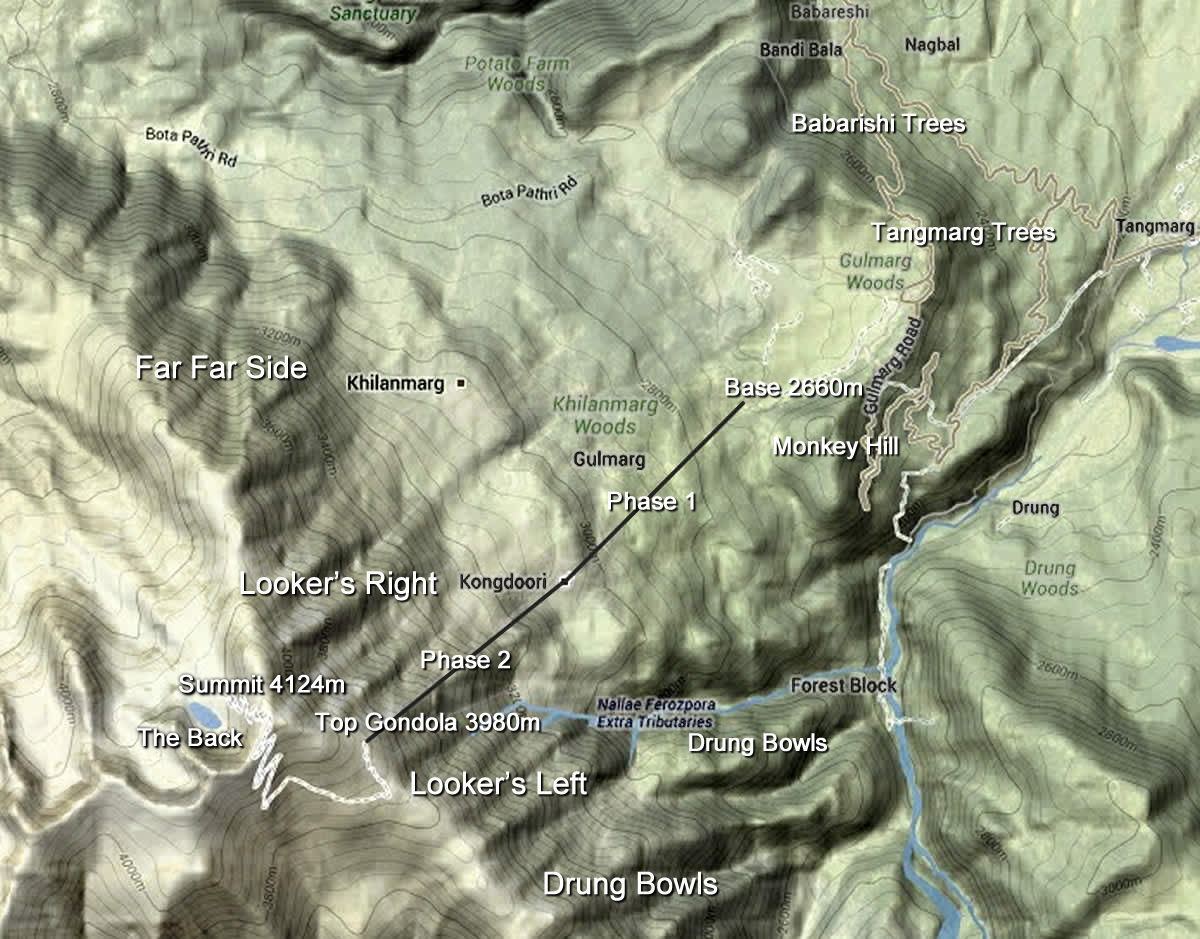
Topographic Map of Gulmarg Ski Resort, Gulmarg Village, Mt. Apharwat Summit, and surrounding areas.
Downloadables
Gulmarg Safety Grid Map
A Gulmarg's Veteran from Autralia created a grid image of Gulmarg Resort. For your safety, please download a copy, laminate it and carry it with you while riding Gulmarg. If rescue is needed, it will make the process of locating your group faster.
Download the Gulmarg Ski Safety Grid.